

This Man Travelled 1,250 Kilometres from Lake Superior to Manitoba—by Canoe
 Updated: Oct. 22, 2021
When the folks at Trans Canada Trail approached me to map out a canoe trail from Thunder Bay to Manitoba, my first thought was, "No way, too much work!"
The world’s largest intact Aboriginal trail systems
I draw maps; been drawing them since I was a teenager. It’s an obsession with me—a way to indulge in a passion to preserve what I explore. Maps and drawings find their collective way into journals I’ve kept describing various adventures and explorations, and, later, into the several guidebooks I’ve produced. I stopped calculating the distance I’ve travelled across Canada, but my journals, and my aching joints, tell me that my explorations have gone well beyond the 60,000-kilometre mark, spanning almost half of our great country.
My wilderness explorations by canoe, however, are not founded on distance or personal achievements—the notoriety is accepted politely—nor do my guidebooks focus solely on making life easier for the adventuring paddler. My work is born out of a love for the primal beauty of this country, which is often taken for granted and can lead to neglect, industrial intrusion and even more recently—wilderness affected by climate change. All of this presents an element of urgency for me. Canada boasts a healthy portion of wilderness, and still sports the world’s largest intact Aboriginal trail systems—canoe routes. As a worldwide commodity, wilderness is infinitely more valuable as it becomes scarce. This is why my guidebooks embrace the important contributions made by our First Peoples, as well as magnify the significance of a sustainable environment.
When the Trans Canada Trail folks approached me to map out a canoe trail from Thunder Bay to Manitoba, my first thought was, another guidebook? No way, too much work!
A region rife with history, intrigue and ghosts
I knew that any guidebook would take at least four years to complete and that meant living on meagre funds, weeks alone on the trail, isolation, hardship, months of studio cartography—but I caved. I gave in to the “calling” as I always do, the challenge, intrigue and time spent in the canoe became an overriding resolution. It was a region of the country I had not travelled, it was rife with history, pre-history, intrigue and even ghosts, demons and spirits of every variety.
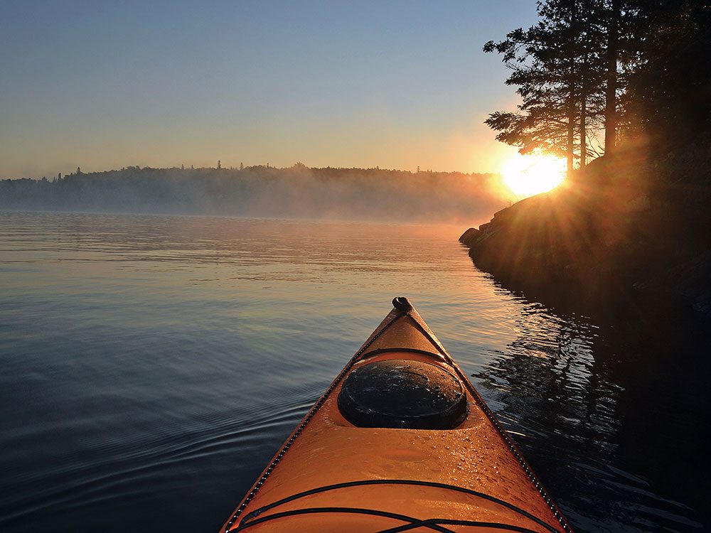
We can’t build a land trail, they said, as it would be too expensive, too hard to maintain. The decision to include the quintessential Canadian canoe route as part of the “Great Trail” was an accidentally brilliant acceptance of the importance of Canada’s first trails. Time constraints and the complexity of constructing a land-based trail aside, in my opinion, a water trail was a necessary and critical component of the Canadian identity. Canoe trails date back thousands of years and still form an essential component of First Nations cosmological beliefs in a connective sense. Canoe trails lead to vision-quest highpoints, incredible pictograph teaching rocks, ancient village settlements and tooling sites. They formed a travel network for trade and access to traditional hunting territories.
With this in mind, I accepted the challenge of mapping out what would amount to five per cent of the total Great Trail—1,250 kilometres.
Check out this love letter to Dominion City, Manitoba.
Exploration is not merely an investigation
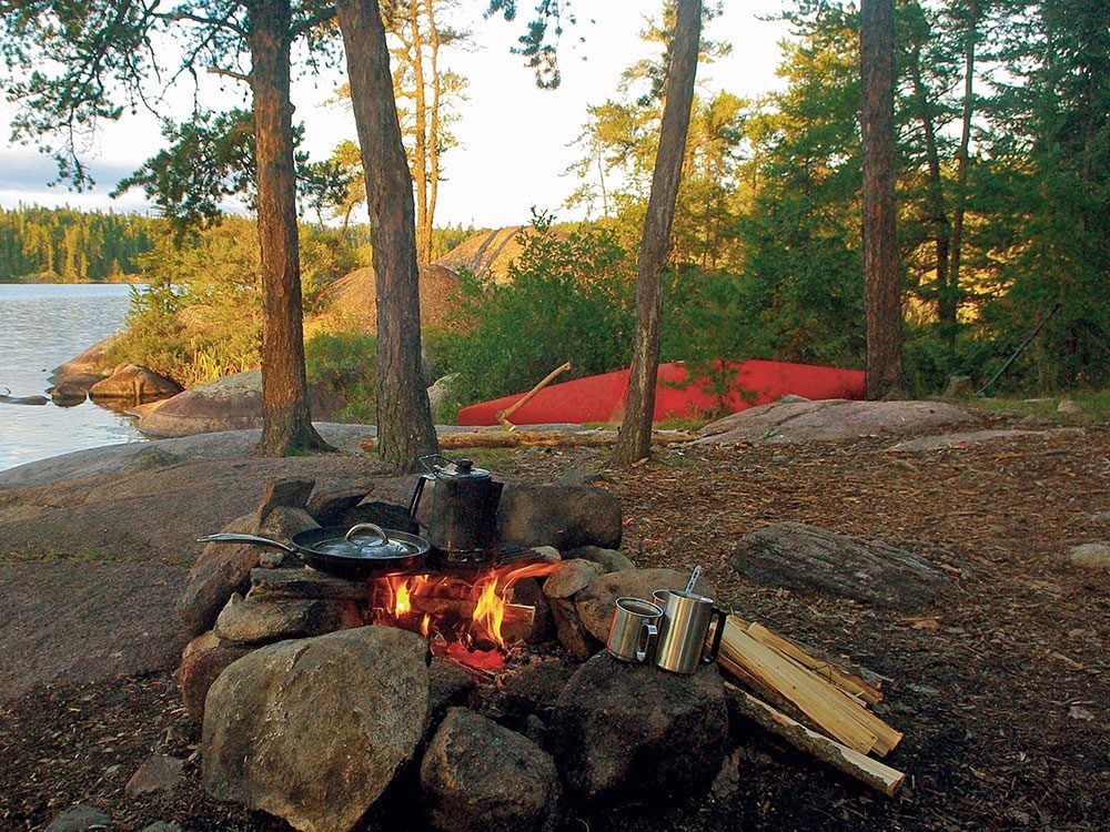
It took seven years to complete, half of which was spent in the studio drawing maps and illustrations. The journey, from the first day I put my canoe in the water to the day when I put the final touches of my pen to the more than 75 hand-drawn maps I created, was nothing shy of extraordinary.
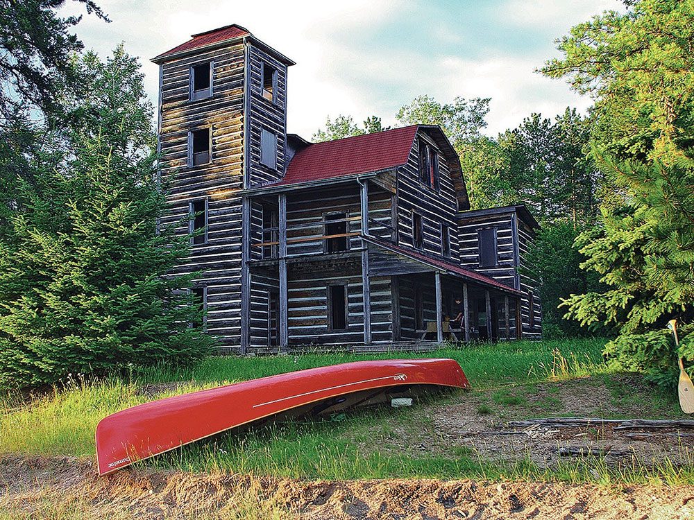
The land across which I travelled—Le Petit Nord—as it was known to the historic interlopers, later named Path of the Paddle in honour of Bill Mason, one of the country’s iconic paddlers, could easily be described as Canada’s heartland. It’s where forest meets Prairie, and lakes and rivers flow in opposing directions. To Indigenous Peoples, it is “where land was formed on the back of the great turtle.”
For me, exploration is not merely an investigation of terrestrial discovery, but an examination of the people who live and have lived there. Path of the Paddle is not defined simply by its beauty or tracts of unprecedented wilderness, but by those who have chosen to make Le Petit Nord their home. People whose passion remains emblazoned in story, tale and historical chronicle. My own adventure in mapping this route pales in comparison to the narrative of events that have taken place here. What Canada was to become would play out here: resolution of border disputes, rivalry between fur-trade companies, exploration and exploitation of resources, all between the plains of Manitoba and the Great Inland Sea.
Read about this epic canoe trip through the Canadian Arctic.
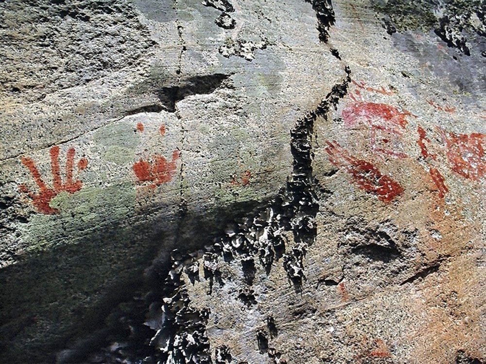
Over 600 habitation and pictograph sites
Before the European invasion, the summer water trails, known as onigum, and the winter trails or bon-ka-naw, were the life arteries of travel and trade for Canada’s First Peoples.
I met regional archaeologist Dennis Smyk from Ignace, Ont., at the Driftwood Diner, very early on in my travels. Dennis had documented over 600 habitation and pictograph sites within the Path of the Paddle corridor. Of visitors to rock painting sites, Dennis remarks that “most are unable or unwilling to interpret or acknowledge beliefs associated with the paintings.” Perhaps a common enough faux pas for those who relate the simplistic style in which rock paintings are presented to mere graffiti, when in fact, the artist-shaman or “teacher of the upright life” presented them as a message, a historical account or teaching. Dennis says the “spiritual teaching sites were carefully chosen for their geographical location, associated environment and rock type, but also for their spiritual pith or energy.” Leaving medicine bundles or offerings were and still are a mandatory show of respect.
Path of the Paddle, land of the Anishinaabe, or Ojibwe People, or “beings made out of nothing,” according to Ojibwe linguist and author Basil Johnston, held dominion over the lands surrounding Lake Superior, west to the Prairies. Their traditional territories sport the heaviest concentration of pictographs and spiritual sites in all of Canada.
Don’t miss these 10 mind-boggling facts about Canada.
Connecting the dots on a very large map
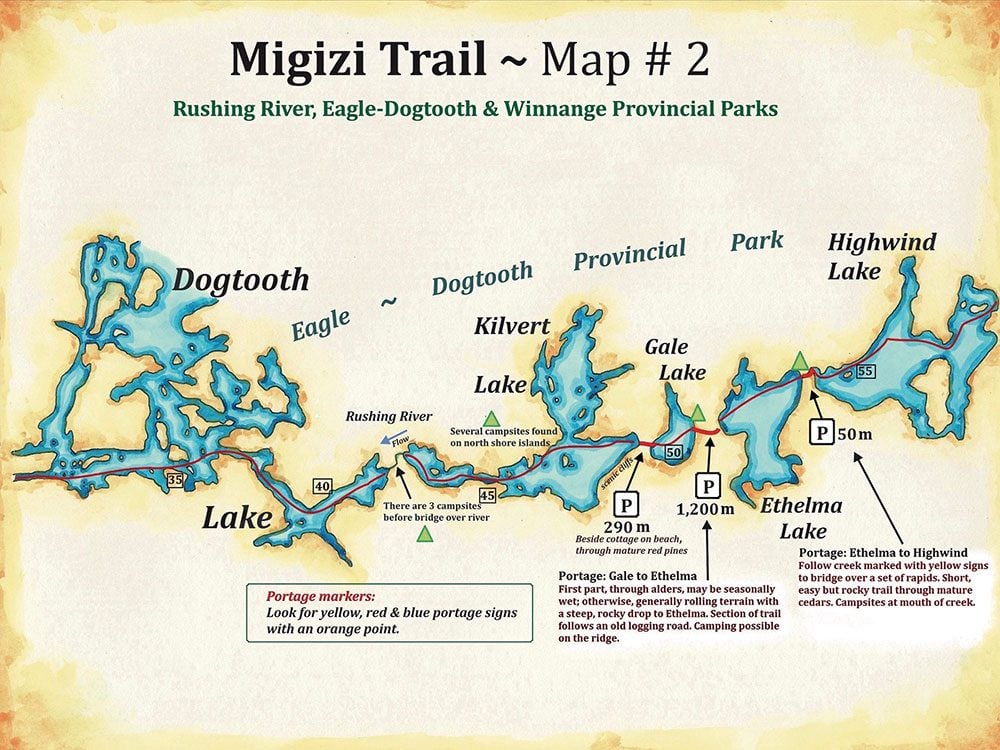
My book is not just about mapping one contiguous linear path, but a collection of connected canoe trails. Although a paddler could embrace the notion of making a go of it in one multi-faceted journey, in either direction, my selection for the book includes seven very different water trails. Each segment for the guidebook was scrutinized for Indigenous correlation, landscape anomalies and the nature of connective water configurations. Not an easy task when attempting to stick to a particularly tight set of guidelines and criterion.
Because this is not a book that simply depicts unique Canadian landscapes, it was also principled to include the communities along the way—like connecting the dots on a very large map. The Great Trail was initiated to connect people to the Canadian landscape; with that in mind, to configure a workable water trail, it was necessary to find a suitable route within the reach of several towns, First Nations villages and convenient points of access. Not an easy task when trying to blend wilderness with settlement, or areas of industrial development. The reality of the Canadian identity is one of many faces. The veracity of exploration is also obliged to meld humanity with the environment in which said humanity lives.
The Canadian landscape is changing, and wilderness is dwindling as the country evolves and the demand for resources becomes greater. Lake Superior to Manitoba by Canoe: Mapping the Route into the Heart of the Continent does impress upon the reader the need to preserve and protect, but also to respect the connection our First Peoples have with the land we call Canada.
Next, check out every UNESCO World Heritage Site in Canada.