

How to Have an Unforgettable Road Trip—Without GPS
 Updated: Aug. 06, 2019
No GPS? No problem! Armed with nothing but an old-school CAA map, these Canadians embarked on a California road trip to remember.
The Lost Art of Navigating By Map
On a flight from Toronto to San Francisco last August, I kept looking up from my book to monitor the animation showing our progress on the seat back in front of me.
Moments later, in an uncanny conflation of worlds real and imagined, I found myself reading about that same experience.
“No invention has been more contrary to the spirit of cartography than these airplane maps,” writes Valeria Luiselli in her 2013 compilation of essays, Sidewalks. “A map is a spatial abstraction; the imposition of a temporal dimension—whether in the form of a chronometer or a miniature plane that advances in a straight line across space—is in contradiction to its very purpose.”
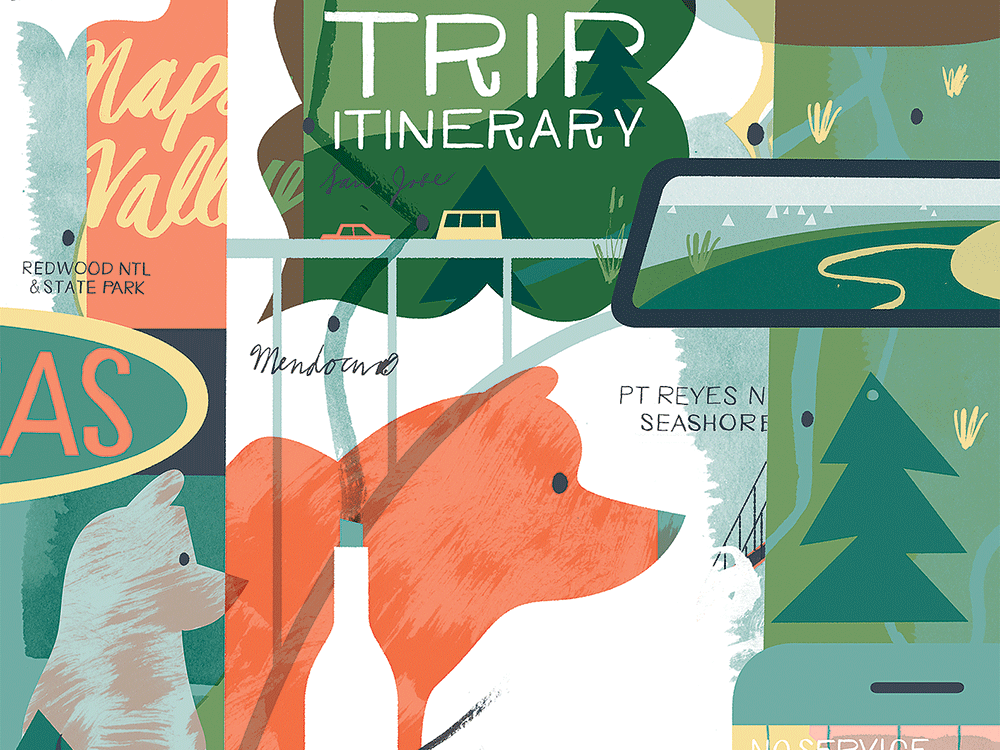
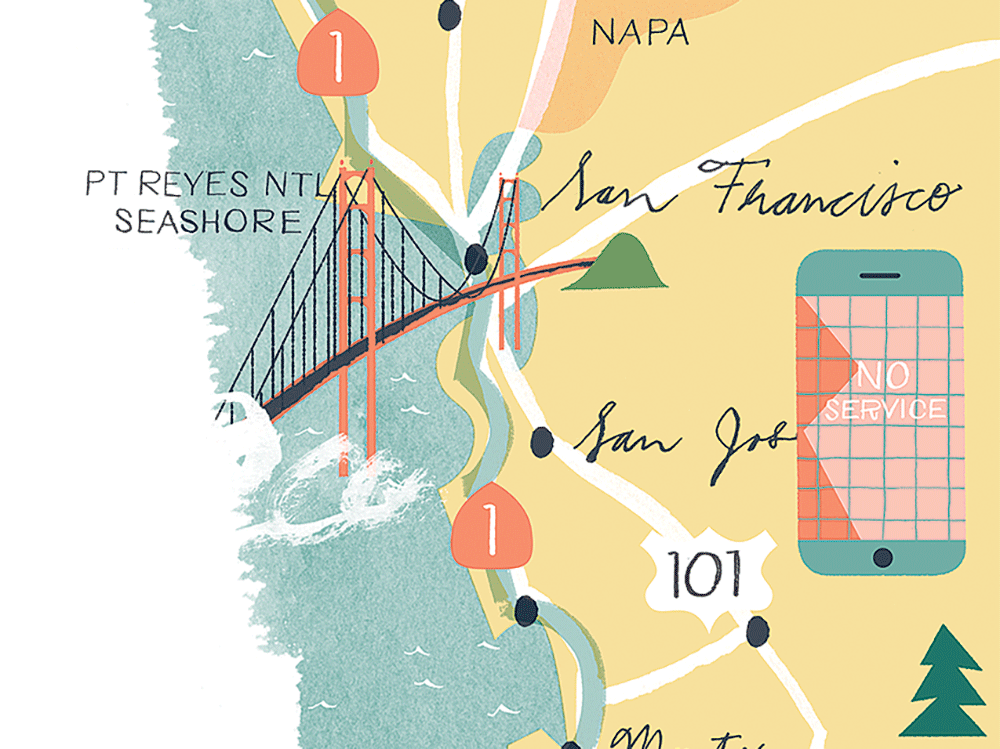
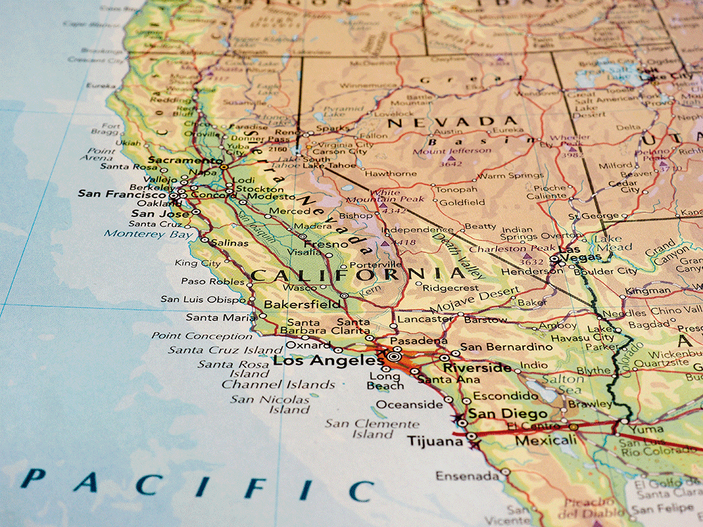
This passage resonated with the plans my partner, Vanessa, and I had made for our California holiday: a two-week California road trip that would begin in the Bay Area, trace the coast down to Big Sur, then zip back up through Napa Valley and the redwoods before heading north into Oregon.
At home in Toronto, booking campsites and bed and breakfasts online, Vanessa had mentioned that, years ago, her family had blazed a similar trail using something called a TripTik Travel Planner. I’d never heard of such a thing, as my own family vacations had tended to involve rented cottages (fun) and culturally edifying visits to India (less so).
TripTik, she explained, is a service provided to members of the Canadian Automobile Association. Back in the late 1980s, when Vanessa was a kid, her dad would head to the local CAA outlet with a holiday plan, and an agent would plot a route for him in highlighter on a series of coil-bound maps. The TripTik was supplemented with relevant TourBooks, which detailed regional attractions, accommodations and restaurants along the way. I was intrigued: like many quintessentially Canadian experiences that often elude the kids of South Asian immigrants (hockey, sloppy joes, sunburns), this seemed like something I might reclaim now, as an adult.
One of the great ironies of the coast around Silicon Valley is that it hosts a number of wireless dead zones. So, faced with the prospect of being technologically marooned, we decided not just to TripTik our route but to forgo satellite navigation entirely—no GPS, no Google Maps, no smartphones. Maybe freeing ourselves from virtual mediation would foster a more engaged travel experience; maybe it would be inconvenient and irritating. But for the sake of nostalgia, both real (hers) and invented (mine), we thought we’d give it a shot.
Voyage Into the Unknown
In the early 20th century, as the automobile began populating the public imagination and the roadways of North America, drivers formed regional motor clubs to lobby for their own interests. In 1902, nine independent chapters in the United States banded together to create the American Automobile Association. Eleven years later, an equivalent federation was established north of the border, officially becoming the Canadian Automobile Association on March 8, 1916.
A century later, CAA counts roughly 6.2 million members. After almost 70 years of guiding intrepid Canadians around the continent, the association stopped handing out its hand-drawn offerings last year. Instead, it now directs road trippers to their online TripTik Travel Planner, accessed by about a million people annually. So our trip to California, we like to think, was guided by one of the last handmade TripTiks ever.
Although CAA was phasing out the service, the Brantford, Ont., store agreed to put together a paper package for us. “Picture a snow-clad mountainside,” instructed the authors of the Northern California TourBook. “A man and a woman in ski gear swoosh down an alpine slope. Cut to a sun-washed beach hours later. The same twosome strolls along the shore, water lapping at their feet. Then, at a swank urban bistro that evening, they sit across from each other savouring a sumptuous dinner.” (Yes! Swoosh! This would soon be us!)
The TripTik seemed dubious: its coils were flimsy plastic, its paper only a grade or two thicker than newsprint, and our route, drawn by hand in green marker, wobbled from one section to the next. I was uncomfortably reminded that travel used to be a voyage into the unknown. There’s been a huge ontological leap from poorly folded road maps stuffed into gloveboxes to the immersive environments of Google Earth and dashboard navigation that responds to traffic and weather in real time.
Now that cartography includes another dimension, mapping is no longer a guide so much as a project of perfection: the best route, available immediately, updated live as you drive it. That we were heading to another country without that sort of guidance felt as foolhardy as it did liberating. What if we drove off the page?
Going Off the Page
Our first human interaction in America was at a San Francisco airport rental-car desk. For 45 minutes, the man behind the counter performed a bewildering dance of legalese and bogus charges, including a $150 pass to traverse California’s toll roads. But, helpfully, our TripTik informed us that we would need to pay a total of only US$6 to cross the Golden Gate Bridge before flying back to Canada. Salesman thwarted, we got our car and hit the road.
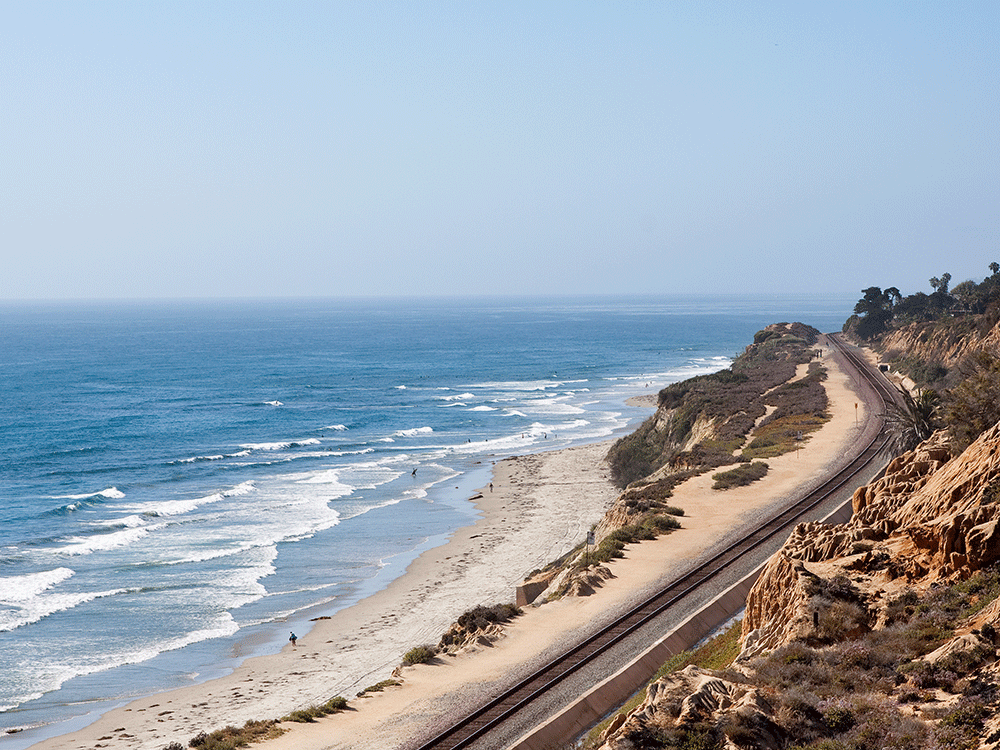
The CAA TourBook’s alliterative claim that the SR 1 highway “snakes along … in a seemingly endless series of sinuous S-curves” didn’t prepare us for the jaw-dropping beauty around almost every twist and turn. And though our TripTik identified it as a single location, Big Sur actually encompasses a broad swath of stunning coastline, bordered by Carmel in the north and San Simeon in the south, from which the Santa Lucia Mountains heave inland. We stayed that first night at a semi-rustic, cripplingly expensive resort nestled in the woods off the highway; like many American restaurants, the affiliated “roadhouse” seemed to assert its patriotism via portion size.
TripTik aside, on our daily excursions up and down the coast, we were often so flabbergasted by the views that we overshot exits and missed turns. There were limits to its purview as well: a few days in, heading back inland, we trawled every inch of the numbingly nondescript city of Gilroy in a panicked attempt to buy Vanessa a rain jacket (never worn). And in Ashland, Oregon, we wandered the downtown for 40 minutes before locating the Shakespeare Festival, where we had tickets to see Pericles—a play, it so happens, about being cast adrift and succumbing to chance.
Once, we even got lost in time. Having successfully TripTik’d our way to Shelter Cove, which marks the southerly start of the portentously named Lost Coast Trail, we thought we’d do a portion of it as a day hike. Since the route skirts the ocean for 40 kilometres, much of it is passable only at low tide and requires strict adherence to tide charts unless you wish to be swept out to sea.
Comparing the map and a newly acquired chart, we figured we had a couple of hours to get out to a point about six kilometres down the trail before the surf came in and we’d have to turn back. A spot on the horizon seemed to correspond to this marker, so we set out for it with one eye on the ocean and the other on our watches.
The walk, over loose stone and wet sand, was gruelling, especially with our matching his-and-hers bum knees (MCL and ACL tears, respectively). On and on we trudged, and that little promontory grew no closer. An hour passed, then another.
We stopped for water; we hurried past a bear and her cubs lumbering around in the trees up the bank. And still our goal seemed unreachable.
Then Vanessa looked back. “Um,” she said, “do you think maybe we’ve already passed it?” She seemed to be right: a couple kilometres back, the waves were hungrily “lapping,” as per our TourBook, at a jut of rocks that resembled the one on our map with remarkable precision and over which we’d scampered an hour or so prior. After wading back to the trailhead and retreating in drenched shame to our hotel room, we realized that if we’d gone any further, our only option would have been to bivouac up into the woods, where that bear and her cubs had lain in wait.
Ready to hit the road? Here are 12 Must-Have Accessories for Your Next Road Trip!
The Beauty of Getting Lost on a Road Trip
It can be kind of nice to get lost—for a little while. “Leave the door open for the unknown, the door into the dark,” writes Rebecca Solnit in her 2005 book, A Field Guide to Getting Lost. “Getting lost is not a matter of geography so much as identity, a passionate desire, even an urgent need, to become no one and anyone, to shake off the shackles that remind you who you are, who others think you are.” In these wired times, that seems easier said than done. You’re often just a couple of clicks away from rescue, be it in the form of social media’s salve for loneliness or an escape route plotted on your phone.
The thing is, I don’t actually need to lose my way to feel lost. I’m disoriented any time I don’t know what to expect around the next corner. When I kept comparing a hike in the Redwood National Park to the Green Gardens walk in Newfoundland’s Gros Morne National Park, Vanessa remarked on this constant need for analogues. It seems a human enough tendency to comprehend through association, but I have to confess: the unfamiliar makes me anxious until I’ve slotted it into some pre-existing category of understanding.
So when I travel, I require an anchor. And though the TripTik was just a few sheets of paper, it started to serve as a sort of cultural touchstone. CAA has always struck me as one of those intrinsically nationalistic organizations, akin to Canada Post, the CBC or the CFL. The TripTik became my link to home.
Our TripTik wasn’t just a guide to our vacation; it provided a vacation in itself. Travelling a route sketched for us by human hands, liberated from technology’s mediating influence, I experienced less a personal emancipation than a reversion to my more basic instincts. A paper map has edges; a virtual map sprawls limitlessly over the surface of the globe. The spatial limitations of the TripTik created a sense of finitude and constraint; you have to trust yourself a little more, especially when you find yourself beyond its pages.
We’d booked our final night in California at a lodge on the Russian River, planning to go out for a nice meal and relax before a leisurely drive back to San Francisco the next day. After we checked in, Vanessa fired up her phone to prepay our toll across the Golden Gate Bridge and asked me the date. “September 8,” I said with confidence. “And we fly out September 9 at five in the morning.” With dawning horror, she looked from me to her phone and back. “That’s in 10 hours!”
There’s a special kind of ineptitude that treads the line between adventure and annoyance. I won’t claim to have been happy about racing down Highway 101 at 2 a.m. to catch our flight home. Nor would I suggest that a mobile device, programmed with some sort of alert or alarm, would have entirely prevented such a thing. Those were a silent, tense few hours in the car, each of us blaming ourselves and each other equally.
But by the time we got to the airport, our moods had lightened. “Well, we made it,” said Vanessa, and kissed me on the cheek. I smiled, kissed her back. We had, indeed. This, too, had already become just another story.
© 2016 by Pasha Malla. From The Walrus (July/August 2016).
Next: We’re counting down Canada’s 10 Best Road Trips!